Aneki.com provides statistical facts, figures, and rankings for over 190 countries in Africa, the Middle East, Europe, Asia, North America, Central America, South America, and Oceania. Current listings are divided into four categories -- economic, social, technological, and environmental -- and are retrieved from sources such as the CIA World Factbook and Forbes.com. Although the site has...
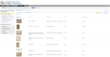
The Birmingham Public Library has a marvelous trove of maps in their collection and this site is the perfect place to explore almost 1,000 cartographic gems. As might be expected, the maps housed here depict various sections of Alabama, along with maps and atlases from Europe, Africa, and other regions of the world. First-time visitors might start by giving close attention to the Persia sive...
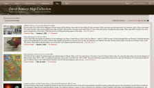
With over 21,000 maps online, the David Rumsey Historical Maps Collection is so vast that it can be hard to keep tabs on all the great new maps that make it to the site. Thus, the Featured Maps area is quite a welcome find for cartographers, geographers, and the just plain curious. Visitors can view all of the recent additions here, which have included collections of map cartouches (or decorative...
Developed by John Walker, the Earth and Moon Viewer supplies updated, interactive maps for the World. Visitors can observe the Earth's Cloud cover, topography, Water Vapor, land and sea temperatures, and more. These maps can simulate views of Earth from the Sun, Moon, and satellites in Earth's orbit. Visitors will also find maps presenting the day and night regions at the moment. Anyone looking...
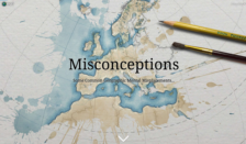
How well do you think you know world geography? John Nelson recently designed this Esri story map, which is all about American geographic misconceptions. This story map is based on an excerpt from a paper published in the 1990s by Central Michigan University geographers Burton D. Nelson, Robert H. Aron, and Mark A. Franck, which outlines common misconceptions of U.S. students in an introductory...
This site presents some of the work produced by the UN's mapping and GIS specialists. Two primary map collections are offered at the site in .pdf format: general maps (over 100) and deployment maps of peacekeeping missions. Both can be browsed via a pull-down menu or on separate pages via the toolbar at the top of the main page. The general maps page organizes maps by region, while the...
A collection of non-copyrighted "electronic maps" are available for viewing and downloading (in JPEG and GIF formats) from the Perry-Castaneda Library (PCL) of the University of Texas at Austin. The maps are indexed by geographical region and country, and dates range from the early 1800s to as late as 1995. In addition to PCL's own collection there is a link to "other map-related web sites" which...
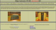
Philippe Vandermaelen's 1827 Atlas Universel is a truly remarkable work consisting of 380 conically projected maps and 40 pages of statistical tables in six volumes. It was the first atlas produced by the then novel printing process known as lithography. As part of a special project funded by the Friends of the Princeton University Library, these maps were digitized and placed online here....
WorldAtlas.com was created by the maps company Graphic Maps in an "effort to aid students, teachers, travelers and parents with their geography and map questions." The information-rich site lets users explore countries of the world through a wide array of maps, descriptions, current times, flags, populations, land size, and links to other relevant sites. Other items of interest include geography...