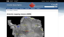
Images from the Antarctic Mapping Mission (AMM) are now available. The goal of the AMM is to complete the mapping of Antarctica using high resolution imaging. The Canadian Space Agency's RADARSAT satellite was launched in 1995, with high resolution mapping of Antarctica beginning September 26, 1997. RADARSAT furnishes standard-2 images of the south pole beginning on September 13.
As a "continent devoted to science," Antarctica offers countless opportunities for researchers from around the world to learn about the history and mechanics of the earth. Exploratorium's latest offering highlights the ice-covered continent and the scientists who have and are studying it. The site includes simple descriptions, exceptional photographs, maps, and learning tools. One unique highlight...
Developed and maintained by the US Geological Survey (USGS) and funded by the National Science Foundation (NSF), the Atlas of Antarctic Research is intended as "a reference, an information framework, an education tool, and a research aid ... [to] promote greater geographic awareness of the continent and the digital geospatial data that describe it." Atlas parameters include Polar Stereographic...
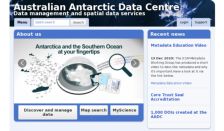
The Australian Antarctic Division is part of the Australian Government's Department of the Environment and Heritage. Within the department's Web site is the Australian Antarctic Data Centre, which makes all scientific observations and results freely available. Data topics include weather, GIS and mapping, marine science, flora and fauna, and many other topics related to the southern continent.
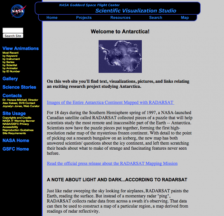
Last week, scientists released images from the first high-resolution radar map of Antarctica. Taken over a period of eighteen days in 1997 by a NASA-launched Canadian satellite called RADARSAT, the images have revealed a number of amazing features never seen before. The most important of these is a complex network of ice streams, huge rivers of ice that move ice and snow from the continent's...
In a 1997 collaborative effort, NASA launched the Canadian Space Agency's RADARSAT Satellite which spent eighteen days over the Southern Hemisphere forming the first high-resolution radar maps of the Antarctic. RADARSAT's unusual capabilities make it possible to capture data even through darkness, clouds, and fog. Unveiled to the public on October 18, 1999, the new maps are so clear and detailed...
The US Geological Survey provides this site, an interactive database that allows the user to query over 12,000 Antarctic geographic names by Feature Name (variant name searching is also supported), Feature Type, Elevation, Description, and Location (latitude and longitude). Retrieval contains all of those variables and a map generated by the Xerox PARC Map Server (discussed in the November 25,...