Based in New York, the people behind the Green Atlas have been going "green" since 1995. The Green Map system is an "adaptable framework for charting nature and culture in hometown environments." Recently, they published the Green Map Atlas, and now visitors can access the entire publication on this site. The Atlas includes maps of Jakarta, Kyoto, New York, Milwaukee, Toronto, and six other areas...
The map library at the University of Chicago has thousands of maps documenting everything from the growth of early cities in the Islamic world to the ethnographic breakdown of Chicago's neighborhoods. In the past several years, the library has been working to digitize some of its maps that document Asian cities in the late 19th and early 20th centuries. The growth of some of these cities in the...
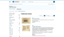
The Library of Congress's Cities and Towns collection features over 3,000 digitized maps of cities and towns. While the majority of these maps portray U.S. cities, the collection also includes maps of cities in China, Brazil, Canada, and a handful of other countries. Visitors can browse this fascinating collection by year (approximately 2,000 of these maps date from the nineteenth century; the...
What will the future of cities be like? It's a riveting question and one that excites the passions of the folks at The Atlantic Cities website. Their work here "explores the most innovative ideas and pressing issues facing today's global cities and neighborhoods." Visitors should browse through their newest articles, which might include "Why Our Kids Need Play" and "How Poverty Taxes the Brain."...
Designed to serve the needs of the University of Chicago community and its many visiting scholars, the University of Chicago Map Collection contains approximately 420,000 maps, 10,000 air photos, and 2000 books. While only a small fraction of these materials can be found on this site, scholars and members of the general public will be delighted to learn that many maps that document the changes...
Developed as part of President Franklin D. Roosevelt's massive package of assistance programs designed to pull the United States out of the Great Depression, the Works Progress Administration (WPA) was known for employing thousands of artists to paint murals in federal buildings and for also employing thousands of the nations' unemployed in hundreds of massive construction projects around the...