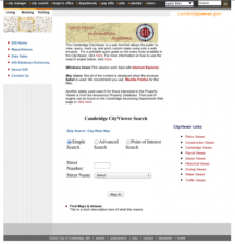
What is the best way to experience the city of Cambridge, Massachusetts? You could read a history of Harvard University, take a walking tour, or perhaps browse a topical website. But why not look at the Cambridge CityViewer for edification? This unique tool "allows the public to view, query, mark up, and print custom maps using only a web browser." Notedly, the viewer works best with Internet...
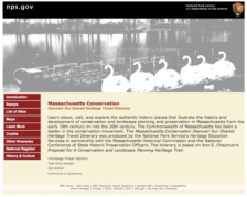
Massachusetts has long been a leader in the conservation and preservation movements. From early attempts to create an Emerald Necklace around Boston to the battle to save the Old State House, the commonwealth has rich, fascinating tales and experiences. This wonderful travel itinerary was created by the National Park Service's Heritage Education Services in partnership with the Massachusetts...
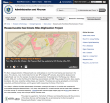
What buildings were in the Fenway area of Boston in 1908? How about in Worcester in the 1870s? The state of Massachusetts has answers to these questions via its collections of real estate maps from the late 19th and early 20th centuries. All told, the State Library's collection includes over 200 atlases, covering 6,500 maps from 12 counties and more than 80 municipalities. Assisted by funds from...