The Library of Congress maintains the online map collection Web site which contains maps from 500 years in seven different categories. The site, entitled Map Collections: 1500-1999, can be browsed by cities and towns, conservation and environment, discovery and exploration, general maps, transportation and communication, military battles and campaigns, and cultural landscapes. The database can be...
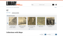
One of the more impressive historical map sites on the Internet is: the Rare Map Collection at the Hargrett Library, University of Georgia. Hargrett's collection contains hundreds of images, and, as might be expected, specializes in Georgia historical maps. However, it also contains many national and international maps from the early new world, colonial, US Revolutionary and post-Revolutionary...
A collection of non-copyrighted "electronic maps" are available for viewing and downloading (in JPEG and GIF formats) from the Perry-Castaneda Library (PCL) of the University of Texas at Austin. The maps are indexed by geographical region and country, and dates range from the early 1800s to as late as 1995. In addition to PCL's own collection there is a link to "other map-related web sites" which...