New Hampshire has roots in British colonial history, beginning as part of Massachusetts before it became its own state in 1788. Over the past three centuries or so, explorers and others have seen fit to map the Granite State for purposes political, cultural, and otherwise. This great digital collection from Dartmouth College brings together over 125 maps dating from the early 1770s all the way up...
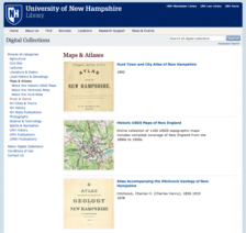
From Durham to Dover, this collection of New Hampshire maps and atlases is a real find for geographers and those who love cartography in general. Items here include the 1892 Hurd Town and City Atlas of New Hampshire, an 1878 atlas of New Hampshire geology, and a remarkable 1717 Gazetter of the State of New Hampshire compiled by Eliphalet and Phinehas Merrill. The site also contains 1,100 historic...