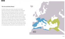
Since Scout’s founding in 1994, our staff has included a steady stream of map lovers. The Scout Report has featured maps of small townships in the south of England, maps of uncolonized territories in the American West, maps of ancient Indian dynasties - and with this resource, 40 maps that explain the Roman Empire. This fascinating collection brings the political, social, and economic realities of...
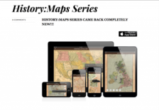
This app, which is designed to be compatible with iPhone, iPad, and iPod Touch (iOS 5.0+) features 178 historical maps from around the world, organized by category or era. The maps are interactive and intended to highlight geopolitical and geographic shifts over time. Perfect for history teachers, or anyone fascinated by history.
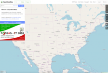
OpenStreetMap is a community-driven alternative to GoogleMaps. It is essentially Wikipedia for spatial data. Like Wikipedia, anybody can contribute new geographic data or refine the existing data. All of OpenStreetMap's data is open data, licensed under their "Open Data Commons Open Database License," which is broadly similar to a Creative Commons Attribution-ShareAlike license. Users may copy,...
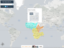
For the past several centuries, cartographers have tried to find different ways to portray the globe on a two-dimensional map. Many of these attempts, including the Mercator projection, distort the true size of different countries and regions. As a result, many of us have false perceptions about the proportional size of different geographical areas. This website, created by James Talmage and Damon...