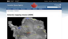
Images from the Antarctic Mapping Mission (AMM) are now available. The goal of the AMM is to complete the mapping of Antarctica using high resolution imaging. The Canadian Space Agency's RADARSAT satellite was launched in 1995, with high resolution mapping of Antarctica beginning September 26, 1997. RADARSAT furnishes standard-2 images of the south pole beginning on September 13.
Circling high above the Earth, Landsat satellites have collected digital image photographs of the planet's continents and coastal areas. The Library of Congress has collected a number of these remarkable images (with the assistance of the United States Geological Survey) and visitors to this site can use the interactive features to zoom in and out on each image. The images have interesting titles,...
For close to thirty years, a series of Landsat satellites have imaged the Earth's surface, returning images for use in a number of business, education, government, and science applications. Of course, many of these images have a great deal of aesthetic value, as those who look at them find themselves marveling at vast deltas, fjords, and land use patterns around the globe. This fine exhibit from...
NASA's Earth Observatory Data & Images page provides periodic updates on data availability. The seventeen datasets listed here include the many types of scientific data collected within the time period 1979-2001, with recent data on 4km2Fires, Ozone, and UV Exposure. By clicking on a specific time period and data type, the user is directed to the appropriate data selection.
Earth Today: A Digital View of our Dynamic Planet is offered by the Smithsonian Institution's National Air and Space Museum and is described as a "state of the art digital theater that's updated several times daily to show near real-time satellite views of the Earth's atmosphere, oceans, and landmasses." The Our Dynamic Earth section contains several topics, such as The Atmosphere, in which users...
The US Geological Survey's Earth Resources Observation Systems (EROS) provides Landsat satellite images from three new sites at its Earthshots site. In addition to the new sites, the previous seventeen sites have been updated. A description of the site, a map, and information about the image are also provided.
As NASA's Earth Observatory Web site describes: "Each year, the North Atlantic Ocean announces springtime by producing 'blooms' large enough to be seen from space." While scientists have had satellite images of these phytoplankton blooms for years, researchers can now detect biofluorescence from these microscopic organisms, with important implications for monitoring the environment. The Web site...
This high-quality collection is provided courtesy of NASA's Johnson Space Center, and it contains over 9,000 images. Visitors can get started by looking over the FAQ area, which provides answers to questions like "Where can I et prints and high-resolution scans of this imagery?" and "What is a 'fuzzy match?'" After this, visitors can perform a full-text search across all of the items, or use the...
Every few years, new satellite images of the earth's surface are acquired from remote sensors aboard a space craft. Because the technology associated with satellite imagery improves so rapidly, these new images generate a wave of excitement throughout the scientific community, representing an opportunity to view the earth's surface at a level of detail (resolution) and accuracy never achieved...
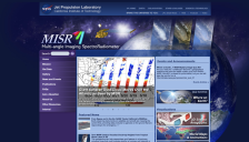
The MISR Image Gallery contains photographs and imagery from the Multi-Angle Imaging SpectroRadiometer experiment being conducted by NASA and the Jet Propulsion Laboratory of the California Institute of Technology. The spectacular images of the Earth are accompanied by descriptions and quizzes about the photographs. The photos are organized in sections: the latest imagery, the main collection of...