Skip Navigation

Scout Archives

Home Projects Publications Archives About Sign Up or Log In

Browse Resources

(20 classifications) (41 resources)

Earthquakes

Classification
Arctic regions (2)
Arizona (1)
Bibliography (1)
California (6)
Colombia (1)
Computer simulation (1)
Databases (1)
Exhibitions (1)
Iceland (1)
Maps (10)
Northwest, Pacific (1)
Observations (10)
Pictorial works (2)
Research (9)
San Francisco (Calif.) (1)
Statistics (9)
Study and teaching (19)
Turkey (2)
United States (3)
Washington (State) (6)

Resources

Earthquake Research Reveals New Information

This brief, three-part report focuses on NSF-sponsored earthquake safety projects. The first section is on the Simmillennium Project, which investigates computer earthquake modeling techniques. The second section concentrates on hospitals, which are particularly difficult to retrofit for earthquake safety because of the sophisticated diagnostic and treatment systems they contain. The report also...

https://www.nsf.gov/pubs/2001/tip010419/tip010419.txt
Earthquakes

Provided by the British Geological Survey, the Earthquakes Web site contains numerous educational topics for kids. Best suited for junior high school students and older, the site contains information on macroseismology (or the observable effects of earthquakes on people, buildings, and nature); seismic hazards; earthquake monitoring; recent and historical earthquakes; and more. Other links on the...

http://www.earthquakes.bgs.ac.uk/
Earthscope

Supported by the National Science Foundation, EarthScope is an ambitious undertaking designed "to apply modern observational, analytical and telecommunications technologies to investigate the structure and evolution of the North American continent and the physical processes controlling earthquakes and volcanic eruptions." This is certainly no small task, and as such it is no surprise that some of...

https://www.earthscope.org/
Screenshot
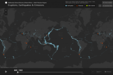
Eruptions, Earthquakes, and Emissions

In 2016, the Global Volcanism Program at the Smithsonian National Museum of Natural History released "Eruptions, Earthquakes, and Emissions." The project presents "a time-lapse animation of volcanic eruptions and earthquakes since 1960." In addition, this animation also incorporates data about sulfur dioxide emissions from volcanic eruptions for every year since 1978, which is when such data first...

https://volcano.si.axismaps.io
Exploratorium: Faultline

How can the drama and power of an actual earthquake be brought online? It’s a difficult task, but the good and talented people at the Exploratorium deserve multiple huzzahs for their fine efforts on this site. Designed to provide some basic information about the nature of earthquakes, the site contains five primary sections. Under the “Quake Basics” heading, visitors can expect to learn about the...

https://www.exploratorium.edu/faultline/index.html
Screenshot
Faultline: Earthquake History and Science | Exploratorium

First mentioned in the April 21, 2006 Scout Report, and significantly revised and updated since, Faultline provides the history and science of earthquakes in an accessible fashion that is appropriate for elementary through high school students and fun for adults. The broad sections of the site remain the same as they were in 2006: Live Eye on the Earth, Great Shakes, Quake Basics, Damage Control,...

https://www.exploratorium.edu/faultline/
NEHRP: National Earthquake Hazards Reduction Program

"The National Earthquake Hazards Reduction Program (NEHRP) is the Federal Government's program to reduce the risks to life and property from earthquakes." After learning about the program's main goals, users of the website can find links to the latest earthquake news and events, publications, seismic maps, upcoming conferences, and other resources. The site describes the model building codes in...

https://www.fema.gov/emergency-managers/risk-management/eart...
OhioSeis: The Ohio Seismic Network

The mission of the Ohio Seismic Network, with 25 stations strategically located throughout the state, is to "detect and precisely locate earthquakes within the state's borders, report the severity and potential damage from an event to emergency response officials, and to rapidly respond to media and citizen inquiries after a felt earthquake." Seismologists can view waveform data, find data on the...

https://ohiodnr.gov/discover-and-learn/safety-conservation/a...
Online Maps and Data

From the California Geological Survey, the Online Maps and Data site contains information focused on natural hazards. Topics include minerals, earthquakes, and landslide and erosion hazards. The site also includes the General Location Guide for Ultramafic Rocks in California. The site also has links to a publications page and a new interactive mapping program called the Seismic Hazards Mapping...

https://maps.conservation.ca.gov/
OpenSees: Open System for Earthquake Engineering Simulation

The Open System for Earthquake Engineering Simulation (OpenSees) is a project of the Pacific Earthquake Engineering Research Center. OpenSees is an open source "software framework for developing applications to simulate the performance of structural and geotechnical systems subjected to earthquakes." The project's homepage maintains resources for users and developers, including downloadable source...

https://opensees.berkeley.edu/
← Previous Next →