The NASA Wavelength website serves as a "pathway into a digital collection of Earth and space science resources for educators of all levels." These resources have been developed through funding from the NASA Science Mission Directorate and aim to answer some important questions like, "How do planets and life originate?" and "Are we alone?" From the homepage, visitors can use the Browse our...
The USGS and NASA have teamed up to bring the public stunning images of the Earth taken by the Landsat-7 satellite and the Terra Satellite's Advanced Spaceborne Thermal Emission and Reflection Radiometer (ASTER). Visitors can browse the images by continent or alphabetically. The images can be used as supplementary materials during educational lectures about rock outcrops, deserts, deltas, clouds,...
The Israel Science and Technology Homepage is the national database and directory of science and technology related sites in Israel. Within this site is the Satellite Images of Israel and the Middle East page. Visitors will find a list of stunning images (acquired from the NASA Johnson Space Center) of the area during the day, at night, its physical features, a topographical view, specific country...
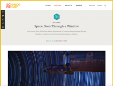
NASA astronaut Don Pettit has been a resident of the International Space Center for three missions totaling 370 days. During those missions, Pettit decided to take a number of photographs, which he recently published in the new book, Spaceborne. In December 2016, Chau Tu interviewed Pettit for the Science Friday podcast. Here readers will find Tu's interview with Pettit, alongside a sampling of...
In 2000 the Space Shuttle Endeavour was able to conserve enough fuel to complete its mission and create the world's most accurate topographic maps. With this site, users can track the mission and view some samples of the extraordinary images being produced. At the SRTM homepage, users will find news updates, background information, some quick facts, related links, an overview of the mission's...
Images from the Spaceborn Imaging Radar-C/X-Band Synthetic Aperture Radar (SIR-C/X-SAR) project are available from 1994 to the present. The radar was launched in 1994 to study the changing global environment. The newest images are available on the main page while older images can be viewed by selecting one of nine categories: Archaeology; Cities; Ecology & Agriculture; Geology, Interferometry;...
In 2000 the Space Shuttle Endeavour was able to conserve enough fuel to complete its mission and create the world's most accurate topographic maps. With this site, users can track the mission and view some samples of the extraordinary images being produced. The STS-99 Mission Status Reports site contains the news from Mission Control.
Astronauts have taken photographs of the Earth from space since the beginning of the space program more than 30 years ago. Today, NASA's Earth Sciences and Image Analysis office offers nearly 400,000 of these images to the public on their Gateway to Astronaut Photography of Earth Web site. The database can be accessed in several ways including a clickable map of the earth, photo number, technical...
NASA's Visible Earth site is a solid and easy-to-use collection of images and animations of our planet. At present, the database holds 4,275 records and may be searched by keyword or advanced search options or browsed by category and topic. Initial returns include a large thumbnail which links to a several-paragraph description and the full-size images or animations. A nice resource for both...