The Canadian County Atlas Digital Project
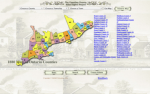
If you have ever wanted to roam through the history of Canada via a selection of excellent maps, this website will be just your cup of tea. The maps here have been digitized by the folks at McGill University and they cover all of Ontario in 1880. There are a number of maps for each county, and visitors can use the drop-down menus to look for items of particular interest. The menus include Choose a County, Choose a Township, and Choose a Town. By clicking on each map, visitors will be able to look at different township maps that will reveal property boundaries, improvements, and all types of other details. Historians and geographers will find much to admire here and it's easy to see how this website could be used in the high school or college classroom to illustrate certain historical trends in terms of land development.
Archived Scout Publication URL
Scout Publication
Publisher
Date Issued
2001
Language
Date of Scout Publication
January 11th, 2013
Resource URL Clicks
32
Internal
Cumulative Rating
0
Comments