Atlas of Historical County Boundaries
Almost five years after we originally featured the Atlas of Historical County Boundaries, we continue to be impressed this website, which allows visitors to explore how county boundaries have shifted throughout history. Our favorite feature? The interactive map that accompanies each featured state.
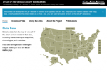
So you'd like to know the boundaries of Washington's King County in the early twentieth century? Or perhaps you'd like to know more about the shape of Nassau County in New York back in the nineteenth century? The Atlas of Historical County Boundaries can provide you such details. The project is housed at the William M. Scholl Center for American History and Culture at The Newberry Library in Chicago and it was completed in 2010. The atlas includes such features as all boundary changes in states and counties, non-county areas, separate map or polygon files for every different county configuration, and lots of other helpful features. Users can get started by clicking on different states of interest and just exploring as they see fit. It's also useful to read over, "Using the Atlas," for additional assistance. Finally, visitors can also look at the publications section for more information on the source material for these county boundaries.
Archived Scout Publication URL
Scout Publication
Publisher
Classification
Language
Date of Scout Publication
January 12th, 2018
Resource URL Clicks
164
Internal
Cumulative Rating
0
Comments