The Digital Archaeological Atlas of the Holy Land
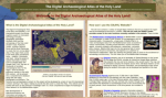
The Digital Archaeological of the Holy Land (DAAHL) is an "international project that brings together experts in information technology including Geographic Information Systems (GIS) and the archaeology of the Holy Land." The remarkable thing about this site is that utilizes Google Maps and vast arrays of archaeological data points to create unique, multi-layered maps that are both informational and rather fun. Visitors shouldn't miss the How can I use the DAAHL website? area, as it provides some nuts-and-bolts information on the operating principles behind the site. A good place to start is the Empires area, which allows visitors to look at map layers that track dig sites through the Persian empire to the time of the Ottomans. It's neat to see the empires shrink and grow over time, transformations that are available to visitors in animated form. Visitors can use the Archaeological Periods section to examine various sites and objects from the Paleolithic to the late Ottoman era. Finally, the site contains complete information about the project's research partners and organizations. [KMG]
Archived Scout Publication URL
Scout Publication
Classification
Required Software
Language
Date of Scout Publication
May 10th, 2013
Resource URL Clicks
159
Internal
Cumulative Rating
0
Comments