North Carolina Maps: Sanborn Fire Insurance Maps
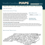
Geographers, historians, and urban planners all enjoy the fantastic Sanborn maps, which were produced from 1867 to 1977 by the Sanborn Company of Pelham, New York. Each map offers a snapshot of the built environment the town or city it covers, complete with information about fire alarms, water mains, sidewalks, frontage, and a host of other germane details that could be used for insurance purposes. The maps here cover the state of North Carolina, thanks to a collaboration by the North Carolina State Archives, the Outer Banks History Center, and the University Library at UNC-Chapel Hill. The project includes original, printed maps of North Carolina published prior to 1923. Visitors can browse the maps by city or county, and they shouldn't miss the Interactive area. This brilliant feature allows visitors to overlay the historic Sanborn maps with current Google Maps to see the evolution of populated areas over time. [KMG]
Archived Scout Publication URL
Scout Publication
Classification
GEM Subject
Required Software
Language
Date of Scout Publication
May 24th, 2013
Resource URL Clicks
63
Internal
Cumulative Rating
0
Comments