Oklahoma Digital Maps
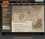
A team of talented librarians at the Oklahoma State University Library have created this collection of 3,600 maps, a true find for those with an interest in Sooner history, geography, culture, and more. The cartographic resources are divided into four collections, including the WPA Collection and the USGS Collection. This first collection consists of almost 2,400 detailed county maps produced in the 1930s by the Works Progress Administration and the Oklahoma Tax Commission to determine real estate values. Moving on, the USGS Collection is made up of 300 detailed maps generated from 1892 to the 1950s documenting topographical conditions throughout the state. Interested parties can view all of the maps here via a nice digital image tool and are also welcome to search across the entire collection by keyword.
Archived Scout Publication URL
Scout Publication
Publisher
GEM Subject
Data Type
Language
Date of Scout Publication
December 13th, 2013
Resource URL Clicks
40
Internal
Cumulative Rating
0
Comments