Neatline
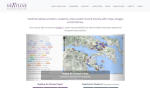
Neatline is a set of geospatial additions for Omeka designed to let users construct geotemporal exhibits that contain "beautiful, complex maps, image annotations, and image sequences" drawn from data stored in a digital collection. It is designed to occupy the space between consumer-grade mapping software such as Google Earth and professional GIS applications such as ArcGIS. The developers aim to make the software "simple enough that college undergraduates can easily use it for class assignments, but also sufficiently flexible, scalable, and feature-rich that it can be used for professional scholarship, journalism, and art." The Showcase tab on the Neatline site highlights a number of digital exhibitions that demonstrate the software's capabilities. The User Guides section provides links to comprehensive installation and usage instructions for both the Omeka Classic and Omeka S versions of Neatline.
Archived Scout Publication URL
Scout Publication
Publisher
Classification
GEM Subject
Language
Date of Scout Publication
July 2nd, 2021
Resource URL Clicks
134
Comments