The Scout Report -- Volume 26, Number 1

The Scout Report -- Volume 26, Number 1
January 17, 2020
Volume 26, Number 1

General Interest

Theme: Geographic Information Systems (GIS)

Tech Tools

Revisited

If you would like to make a tax-deductible contribution to support The Scout Report and the work of Internet Scout, please visit our donation page.

General Interest

Back to Top
Making Modernism: Literature and Culture in 20th Century Chicago
Social studies

From the Newberry Library comes Making Modernism: Literature and Culture in 20th Century Chicago. This digital exhibition explores how the city of Chicago's contributions to the modernist period extend beyond its impact on architecture by focusing on "the literature and art of Chicago in connection with the unique urban, economic, and cultural history of the city." Here, readers will find more than 30 items from the Newberry's archives dated between 1891 and 1953, each carefully selected to illustrate some aspect of Chicago's connection to modernism and accompanied by a short essay situating the item in its historical and cultural context. Examples include the poet Harriet Monroe's handwritten inscription to a friend in a copy of her 1891 book Valeria and Other Poems and two 1937 letters from the writer and anthropologist Zora Neale Hurston to the literary critic Harry Hansen. Making Modernism was born out of two summer institutes for university faculty and graduate students in 2013 and 2017 that were led by Liesl Olson, the Newberry's Director of Chicago Studies, with institute participants choosing the exhibit's items and writing its essays. [JDC]

Comment on or rate this resource

Digital Transgender Archive
Social studies

Based at the College of the Holy Cross in Massachusetts, the Digital Transgender Archive (DTA) is an international collaboration between more than 50 institutions that aims "to increase the accessibility of transgender history by providing an online hub for digitized historical materials, born-digital materials, and information on archival holdings throughout the world." Visitors to this project will find digital collections of more than 8,000 items sourced from a variety of universities, libraries, archives, and private collections worldwide. DTA's holdings can easily be browsed by location, institution, collection, topic, or genre, and the entire archive is searchable and can be filtered by date, language, and other fields. While some of the items in DTA's collections may be considered explicit, for these items the DTA provides prompts that require users to confirm that they are not minors and that they consent to view the materials. For readers who may be less familiar with transgender history, the DTA has created two helpful guides: one about the DTA and transgender history in general and one that focuses on race and ethnicity as they intersect with transgender history. A Glossary and a list of Global Terms, all of which can be found under Learn. [JDC]

Comment on or rate this resource

Failed Architecture
Arts

Launched in 2011, Failed Architecture is an independent foundation based in Amsterdam that publishes thought-provoking articles and podcast episodes that "explore the meaning of architecture in contemporary society," and critically examine "dominant spatial fashions... reaching far beyond the architectural community." Visitors to this resource can easily browse its most recent publications on the main page, and a search bar is available in the header for those seeking a particular topic. First-time visitors may want to begin by checking out "A Decade in Failed Architecture," which features a roundup of their ten most popular articles from the 2010s, as well as highlights chosen by six of Failed Architecture's editors. Other examples of topics include: how London's old Wembley Stadium symbolizes the history of British imperialism, and an examination of Jakarta's "superblocks" and their social dynamics. Failed Architecture's contributors are architecture critics, scholars, and enthusiasts from around the world. Its Editor-in-Chief (as of this write-up) is Mark Minkjan, an urban and architectural geographer who also teaches at the Gerrit Rietveld Academy and the Academy of Architecture, both in Amsterdam. [JDC]

Comment on or rate this resource

AP vs. Chicago
Science

Writers and editors who need to navigate multiple style guides, particularly The Associated Press Stylebook and The Chicago Manual of Style, as well as writing instructors, students, and general "word nerds" should check out AP vs. Chicago. Launched in 2011, this resource was created and written by Karen Yin, an author with over 20 years of experience as a copywriter and editor who was inspired to begin this project after "the publishers of AP and Chicago style both unleashed brand-new (exciting!) editions in 2010." Visitors to AP vs. Chicago will find numerous informative articles addressing various aspects of language style and usage in writing. The main page highlights several featured articles sorted into Funny Posts, which were written specifically for AP vs. Chicago, and Fun-Free Posts, many of which were originally written for publications such as the Copyediting newsletter. Both categories offer helpful and often entertaining discussions of a wide variety of topics, such as how to style text messages in fiction, a comparison of AP and Chicago style rules for numbers, and a list of "Nine Obscure (but Useful) Recommendations from The Chicago Manual of Style." [JDC]

Comment on or rate this resource

American Birding Podcast
Science

The American Birding Podcast "brings together staff and friends of the American Birding Association as [they] talk about birds, birding, travel and conservation in North America and beyond." This podcast was launched by the nonprofit American Birding Association in late 2016, and continues to provide entertainment for bird and nature lovers alike. Host Nate Swick leads informative conversations featuring a diverse range of guests and birding-related topics. Examples of topics from 2019 include: a discussion of female birdsong with ornithologist Lauryn Benedict, a chat with the host and director of the video series Birds of North America (see the 5-24-2019 Scout Report), and explorations of two bird-themed games, a board game named Wingspan and a web-based Fantasy Birding game. Each episode also includes a brief news update from the birding world, such as how various threatened avian species are doing. New episodes released every two weeks and most episodes are approximately 30 minutes long. The podcast's full archives can be streamed and downloaded online at the link above. Those interested can also subscribe via apps such as Stitcher, Podbean, Apple Podcasts, or other platforms. [JDC]

Comment on or rate this resource

Theme: Geographic Information Systems (GIS)

Back to Top
Esri: GeoInquiries
Science

Teachers of a variety of subjects and grade levels who would like to incorporate maps into their classroom activities may want to check out Esri's GeoInquiries, a collection of short, standards-based inquiry activities for teaching map-based content found in commonly used textbooks. Here, visitors will find a library of activities organized by topic, with each topic containing 15-20 different activities. For example, the American Literature section offers activities to enhance students' understanding of books such as The Great Gatsby and Into the Wild, while the Mathematics section offers a range of geometry and beginning algebra activities. GeoInquiries also covers topics such as Earth Science, Government, and World Geography. Each GeoInquiry activity includes a teachers' guide in PDF format, an interactive webmap, and an optional worksheet for students. Most activities are Level 1, which are "activities that teach standards-based content without a login to or installation of ArcGIS Online." Some topics also offer Level 2 activities that use ArcGIS Online analysis tools. Those new to using GeoInquiries should be sure to read through the guide Getting to Know GeoInquiries, which is linked in the introductory paragraph on the collection's main page. [JDC]

Comment on or rate this resource

Directions Magazine
Science

Interested in keeping up with trends in the GIS and geospatial technology industry? Then Directions Magazine may be just the ticket. This site was co-founded by Jane Elliott and her late husband Scott Elliott in 1998 "as the first entirely online geospatial publication." Here, visitors will find an array of articles, interviews, webinars (free, but may require registration), podcast episodes, and more. These resources explore a wide range of current geospatially-related topics, such as the complexities of using geospatial technology to map cultural resources and how an Austrian surveying company successfully dealt with the challenge of capturing high-precision data over a large expanse of the Alps. Menus at the top allow visitors to view content by topic or by type, and the site is searchable as well. Some of the magazine's content was published as multi-part series, which have been grouped together as Playlists. While Directions Magazine is intended primarily for GIS and geospatial professionals and educators, much of its content is largely approachable for non-experts as well. In addition to its own content, Directions Magazine also has a sizable list of publicly accessible online Data Resources. [JDC]

Comment on or rate this resource

Open Topography
Science

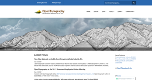
OpenTopography provides high-quality geographic data relating to earth science as well as a platform for researchers to share their own data. Based at the University of California, San Diego, OpenTopography is an ambitious project that "facilitates community access to high-resolution, Earth science-oriented, topography data, and related tools and resources," and is funded through the National Science Foundation. Visitors can search or browse the project's more than 300 datasets (as of this write-up) via an interactive data map and a data catalog, both found under Data. Most of these datasets are available in Lidar point cloud format, and many are also available in other formats, such as raster or Google Earth. Visitors should also check out the Tools section, where they will find descriptions of the tools OpenTopography uses to enable on-demand processing, analysis, and visualization of their datasets. This section also contains their Tool Registry, which they describe as "a community populated clearinghouse of software, utilities, and tools oriented towards high-resolution topography data," as well as OpenTopography's open-source software. For new users, the Getting Started page (linked at the upper left) provides a helpful orientation to the site, and there are also several tutorials on Lidar available under Learn. [JDC]

Comment on or rate this resource

The Geospatial Historian
Science

The Geospatial Historian is "a tutorial-based open access textbook for historical scholars and digital humanists designed to teach practical digital mapping and GIS skills that are immediately useful to real research needs." Under Lessons, readers will find two series of GIS tutorials geared towards historical analysis and applications. The first series, which uses free or open-source software, is comprised of four lessons that the project team created for the Programming Historian (featured in the 7-21-2017 Scout Report). The second series contains five lessons that teach mapping, georeferencing, and other applications using ArcGIS. The site also offers a helpful list of resources for Finding Spatial Data, organized by data type and featuring data from around the world with an emphasis on Canada, as well as a link to a roundup of example HGIS Projects. The Geospatial Historian is edited by environmental and digital historians Jim Clifford and Josh MacFadyen, who teach respectively at the University of Saskatchewan and the University of Prince Edward Island. [JDC]

Comment on or rate this resource

Geospatial Analysis Online
Science

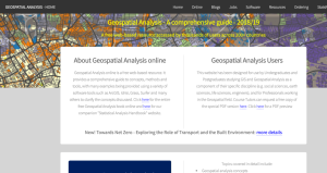
For anyone who needs to learn, review, or teach the concepts and methodologies of GIS analysis, Geospatial Analysis Online is a welcome boon. This resource is a free web-based version of the textbook Geospatial Analysis: A Comprehensive Guide, written by Michael de Smith and Paul Longley of the University College London and by Michael Goodchild of the University of California-Santa Barbara. As of this write-up, visitors to the above link will find the sixth edition of this handbook (published in 2018), which "address[es] the full spectrum of spatial analysis and associated modeling techniques that are provided within currently available and widely used geographic information systems (GIS) and associated software." Some of the topics covered in the book's 10 chapters include an overview of the conceptual frameworks used in spatial analysis, the core components of GIS analysis, discussions of spatial statistics and surface and field analysis, as well as big data as it relates to spatial analysis. This comprehensive guide can be read online in its entirety at the link above. Those interested in purchasing a physical or PDF e-book copy can find links to do so under Ordering. Other noteworthy portions of the Geospatial Analysis Online website include links to GIS-related Blogs, Software, and other Resources. [JDC]

Comment on or rate this resource

Tech Tools

Back to Top
Wings 3D
Science

Wings 3D is a tool for creating and editing polygon models of three-dimensional objects that can be used as components in games, computer-generated images and movies, or 3D printing. The Wings user interface favors context-sensitive menus instead of toolboxes packed with every possible tool a user might want. Users right-click on an object and are presented only with the editing operations that are relevant for that object. Because of this approach, the Wings user interface is generally less visually cluttered than that of similar tools. Some users find this more sparse interface to be easier to use. The Gallery section of the Wings website contains examples of user-created objects. In the Community section of the site, readers can locate general references on 3D modeling principles, manuals specific to Wings, and a number of tutorials. In the Downloads section, readers find installers for Windows, macOS, and Linux computers. [CRH]

Comment on or rate this resource

GNU ddrescue
Science

GNU ddrescue is a tool for recovering data from failing digital media. Often, when a device is dying but not quite dead, data can be successfully read simply by retrying several times. GNU ddrescue uses this fact to copy data from a dead or dying drive to either a new drive or a disk image file. Because the speed of a data transfer from a disk depends in part on the size of the block being copied, ddrescue performs multiple passes over the failing disk using first a large, then medium, and finally a small block size. This technique allows ddrescue to work quickly on healthy sections of a drive while still working carefully with failing portions. It also keeps track of which portions of the disk have been read, allowing users to pause and resume a recovery effort (e.g. to more thoroughly clean a scratched optical disc). GNU ddrescue is free software, licensed under the GNU General Public License and distributed as source code via the project website. Linux and BSD users can install ddrescue via their operating system's package manager, macOS users can use MacPorts or Homebrew, and Windows users can use Cygwin. The website can be read in English, Spanish, French, and Italian. [CRH]

Comment on or rate this resource

Revisited

Back to Top
Bomb Sight: Mapping the WW2 Bomb Census
Social studies

We originally featured Bomb Sight in the 8-28-2015 Scout Report, and this fascinating project is an excellent example of one of the many applications of GIS and geospatial data.

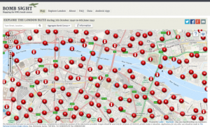
Bomb Sight, a project of the British National Archives, allows readers to experience the World War II bombing of London through interactive maps, photographs, and compelling narratives. The landing page engages readers from the start, where a map of London is covered with numerous red dots, each related to the bombing of that particular location. Selecting one of the dots pulls up the type of explosive and the approximate address of its location, as well as a "Read more" link leading to a page with historical images from the Imperial War Museum's archives related to the area and links to narratives of Londoners' memories about the bombings related to the area. These pages also allow readers to explore statistics at multiple scales, such as how many bombs fell in that particular city ward or borough, as well as in Greater London. In addition to perusing the data via the interactive map, the Explore London tab features an index of bombing statistics organized alphabetically by borough, thus enabling visitors to select a particular area of London and learn about how the Blitz affected that area.

Comment on or rate this resource